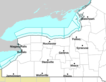
High Wind Warning and Winter Weather Advisory issued for Lewis and Jefferson Counties
FOR LEWIS AND JEFFERSON COUNTIES-...HIGH WIND WARNING IN EFFECT FROM 5 PM THIS AFTERNOON TO 8 PM EDT MONDAY... * WHAT...South to southeast winds 25 to 35 mph with gusts up to 60 mph expected tonight. Winds become southwest Monday with gusts up to 50mph. * WHERE...Jefferson and Lewis Counties. Strongest gusts are expected tonight along the northwest and northern face of the Tug Hill. Strongest wind gusts Monday will be regionwide. * WHEN...From 5 PM this afternoon to 8 PM EDT Monday. * IMPACTS...Strong winds will blow down trees and power lines. Scattered power outages are expected. Travel will be difficult, especially for high profile vehicles. ...WINTER WEATHER ADVISORY IN EFFECT FROM 8 PM MONDAY TO 8 PM EDT TUESDAY... * WHAT...Lake effect snow expected. Total snow accumulations 4 to 8 inches in the most persistent lake snows. Winds gusting as high as 45 mph will produce areas of blowing snow Monday night and Tuesday. * WHERE...Jefferson and Lewis Counties. The highest accumulations are expected across the Tug Hill Plateau. * WHEN...From 8 PM Monday to 8 PM EDT Tuesday. * IMPACTS...Travel will be difficult. The hazardous conditions will impact the Tuesday morning and evening commutes. Gusty winds will down tree branches and cause isolated power outages.