NWS ON-AIR SEGMENT: Severe Weather Outlook for Tuesday, April 29, 2025

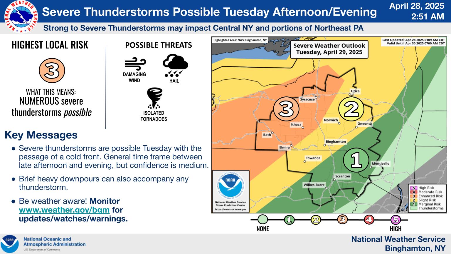
A fast moving cold front is expected to collide with a warm air mass over New York State and the National Weather Service says all the ingredients for a severe weather outburst Tuesday afternoon/evening (April 29) for Central and Northern New York are all in alignment.
The question is: where will it happen and how severe.
According to the New York State Office of Emergency Management, several counties, including Lewis, Oneida and Oswego, are all under an enhanced risk of severe thunderstorms for Tuesday afternoon and Tuesday night.
In our latest on-air segment, NWS Meteorologist Dan Kelly says there is a powerful line of storms preluding just ahead of this cold front that are capable of producing damaging winds, hail, thunder/lightning and heavy rains.
To express the seriousness of this developing storm system, Meteorologist Kelly says that a legitimate possibility of tornados cannot be ruled out.
Be sure to listen here:
Further developments are expected with even more precise information as we progress into Tuesday,
We will be updating our social media, website and NWS based forecasts over the air with any major developments that come in.
NWS images.
